 [Next slide]
[Previous slide]
[Other navigation]
[current slide = 008 of 211]
[Next slide]
[Previous slide]
[Other navigation]
[current slide = 008 of 211]
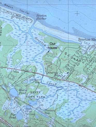
On this segment of the USGS
topographical map of the Sandwich quadrangle, we can see the
entrance to Scorton Harbor from Cape Cod Bay, the east branch of
Scorton Creek behind the barrier beach, and the west branch of
Scorton Creek extending behind the beachfront cottages. We also
can see the main channel of Scorton Creek winding its way through
the marsh to the bridge at Route 6A, shown here in red. South of
Route 6A, the creek diverges into several tributaries through the
marsh, one of which reaches Jones Lane at the right edge of the
map, whence it flows on to meet the Great Marsh of Barnstable.